 Zambia Geoportal (Demo)
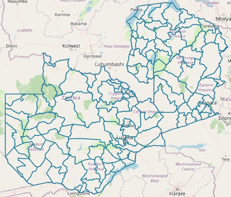
Districts
Zambian districts
Simple
- Date (Publication)
- 2024-11-20T14:22:00+03:00
- Status
- On going
- Point of contact
-
Organisation name Individual name Electronic mail address Role DAI
Florent Lasry
Originator
- Maintenance and update frequency
- As needed
- Stratum
-
- Place
-
-
Districts
-
- Access constraints
- Copyright
- Use constraints
- otherRestictions
- Spatial representation type
- Vector
- Denominator
- 50000
- Language
- English
- Character set
- UTF8
- Topic category
-
- Boundaries
N
S
E
W
))
- Reference system identifier
- WGS 1984
- OnLine resource
-
Protocol Linkage Name OGC:WMS
https://www.znsdi.net/geoserver/gn/wms Districts
- Hierarchy level
- Dataset
Metadata
- File identifier
- e92e497f-dd87-4f31-a4f5-689f301c199e XML
- Metadata language
- English
- Character set
- UTF8
- Date stamp
- 2024-11-21T14:11:44.230695Z
- Metadata standard name
-
ISO 19115:2003/19139
- Metadata standard version
-
1.0
- Metadata author
-
Organisation name Individual name Electronic mail address Role Point of contact
)))